The next generation of geospatial professionals are being developed at the Auburn University College of Forestry, Wildlife and Environment (CFWE).
One of the few programs in the Southeast, Auburn’s Geospatial and Environmental Informatics (GSEI) undergraduate degree program employs a unique, interdisciplinary approach to teaching geospatial systems and technologies that prepares students for careers such as environmental data scientist, geospatial analyst, or GIS manager.
Today, more than ever before, students at Auburn will have opportunities to pursue this exciting and lucrative career path as traditional freshman or transfer students.
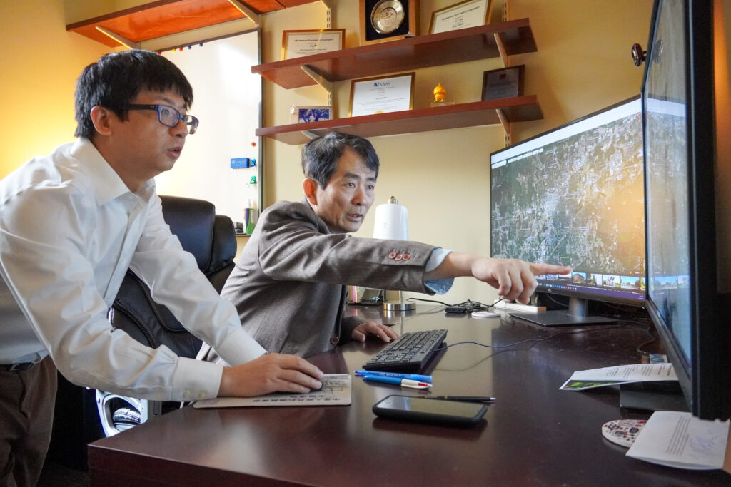
Zutao Yang, CFWE assistant professor (left), and Li An, Solon & Martha Dixon Endowed Professor (right), survey satellite imagery maps together.
Accessible Degree
Todd Steury, associate dean of academic affairs and professor of wildlife biology at the CFWE, said this flexibility within the program is intentional.
“We have recently restructured the curriculum for students to easily transfer and apply elective courses toward the major,” said Steury. “This makes it accessible for those students who discover the major as sophomores to have a timely graduation.”
Steury adds that the addition of statistics-based courses allows GSEI students to further develop their analytic capabilities and make evidence-based decisions. Some of these courses include data quality assessment, hypothesis testing and inference, modeling and prediction, and data exploration and visualization.
The CFWE’s Director of Student Services Ginger Donaldson says thanks to free and restricted elective courses, undergraduates will have opportunities for greater flexibility and diversification of skills.
“The freedom of choice in an academic program is highly impactful,” said Donaldson. “Choice empowers students to take ownership of their academic journey. For some, that can be as simple as having the flexibility and freedom to schedule classes around other commitments such as work that allows them to continue their education.”
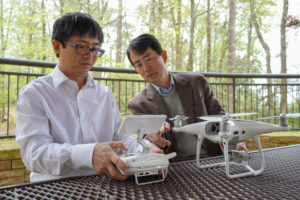
Zutao Yang (left) and Li An (right) test drone systems for aerial reconnaissance.
Emerging Tech Driving Need
Auburn’s GSEI program was introduced in the CFWE in 2017 when researchers, land use planners and policymakers began relying on “Big Data” derived from geospatial technologies to sustainably manage natural resources and the environment.
Geospatial technologies include tools like geographic information systems (GIS), the global positioning system (GPS), satellite-based remote sensing, computer learning simulation and drone imaging.
Auburn GSEI computer science courses are now based on Python, the dominant data science and machine learning program. It is explained in a beginner-friendly language, making geospatial tools and data more accessible to learn.
Beyond its applications for ecosystem management, this decade will see virtually every industry utilize expertise in geospatial technologies to make decisions.
Across the country, the demand is high for professionals with this knowledge, meaning the career opportunities for GSEI undergraduates are endless. In fact, 100% of Auburn GSEI students find employment in the first six months post-graduation.
New Faculty Expand Curriculum, Applications
The CFWE has welcomed many new faculty members with geospatial expertise to facilitate this program. The Solon & Martha Dixon Endowed Professor Li An brings more than 30 years of experience and a valuable skillset that he intends to share with his students.
“My research combines ground observation, remote sensing, process-based and data-driven modeling to study environmental issues,” An said. “This semester, I am teaching a Python Programming for the Environment course, which aims to familiarize students with fundamental programming skills. This is especially useful for them to better understand and solve environmental or natural resources-related problems. I also teach space-time analysis, which will be helpful to reinforce the mechanisms or driving forces that generate data.”
An adds that this curriculum should help students become stronger and more competitive in job markets requiring expertise and experience in data science. Graduates of the GSEI program will also be able to diagnose why certain global factors are occurring in the environment, plan for them and implement actions to resolve problems.
According to An, the college’s Geospatial and Environmental Informatics major is set apart for several reasons.
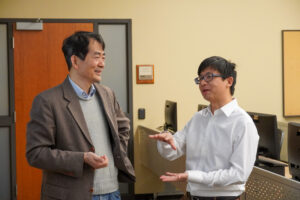
Li An (left) and Zutao Yang (right) discuss geospatial systems.
“The Auburn GSEI program has unique features and strengths from similar programs,” An said. “Unlike a program housed in a geography department, our program has a strong natural resource and environmental management context that allows the GSEI tools, courses and activities to be useful for solving impending and challenging issues facing our society.”
An believes it is this cross-disciplinary focus that will enable GSEI graduates to successfully tackle application and technical problems in their job context.
The GSEI program at Auburn holds this advantage along with a robust and diverse body of faculty with expertise in various natural resource professions. Some of these areas of study include hydrology, remote sensing, modeling systems and space-time data analysis. With this dynamic combination of knowledge, CFWE graduates will be prepared to handle issues in terrestrial, coastal and marine ecosystems.
Zutao Yang, who recently joined the CFWE as an assistant professor, has devoted his work to ecosystem modeling. This research combines ground observation, remote sensing, process-based and data-driven modeling. For environmental studies, these methods are imperative for developing solutions to problems in real time.
He says that the GSEI program is ideal for students interested in the environmental field.
“Students should consider whether they have an interest in areas such as environmental science, geography, spatial analysis and data science-related technology,” Yang said.
“They should also consider the diverse career paths and job opportunities available within GSEI-related fields, such as environmental consulting, urban planning, natural resource management and GIS analysis, as well as research positions in academia, nongovernmental organizations and government agencies.”
Yang also reinforces the CFWE’s interdisciplinary approach to teaching the degree’s technical skills and subject matter.
“In my opinion, Auburn’s GSEI program is unique in its interdisciplinary approach,” he said. “Our major’s strength comes from our faculty who bring diverse backgrounds and expertise to the degree. This provides opportunities for undergraduate students to perform research in a wide range of areas, including wildlife, climate resilience, forest management and more.”
Thinking Big
Cailey Smith, a GSEI major in her junior year, says the diversity of the curriculum inspired her to jump into the program.
“I was inspired by the idea that it combined my interest in technology and conserving the environment,” Smith said. “I like that it always chases the next big idea and is constantly investigating new questions.”
She aspires to complete projects that aim to better connect people and their environment while fostering healthy, sustainable relationships.
Smith’s advice for all prospective GSEI students who may be on the fence about investigating or transferring into the program carries a message of conviction.
“Follow what you are passionate about and what interests you. Always be thinking about how all the classes you take can apply to GSEI,” said Smith.
 All students interested in Auburn’s GSEI program are invited to attend a GSEI Open House on Friday, April 5, at 2:30 p.m. at the Forestry, Wildlife and Environment Building at 602 Duncan Drive, Auburn, Alabama. The event will be held in the EBSCO Atrium and will feature refreshments, snacks and meeting opportunities with GSEI students, faculty and an academic advisor.
“This geospatial program is unique to Auburn, and it provides endless opportunity for CFWE students to have successful and prosperous careers in a wide range of capacities,” said Steury. “We are excited to provide pathways for new, innovative studies and encourage interested students to attend this informational event.”