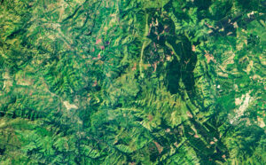
A satellite image of a forested terrain.
A new Auburn University study explains how satellite technology has dramatically improved the way scientists measure carbon stored in forests.
The study, led by Auburn doctoral graduate Janaki Sandamali Kuda Udage, supported by the U.S. Forest Service and NASA-related research programs and published in Advances in Space Research, looks at more than 20 years of satellite laser systems research to estimate how much living plant material, or biomass, is in forests.
Forests hold about 80% of all aboveground plant biomass on land, which means accurate measurements are important for understanding how carbon moves through the environment, ultimately providing important data for shaping climate policy and forest management decisions.
For example, forest managers use biomass and carbon data to identify areas that may need restoration after wildfire, storms or insect outbreaks, evaluate the success of reforestation efforts and prioritize lands for conservation. More accurate measurements also help government agencies and landowners quantify carbon storage for climate reporting and carbon credit programs, while enabling researchers to better predict how forests will respond to changing environmental conditions.
Advised by Auburn Associate Professor of Geospatial Analytics Lana Narine, Udage and Auburn’s Geospatial Analytics Lab analyzed 52 peer-reviewed studies from 13 countries published between 2003 and 2024. She tracked how Earth observation tools for estimating forest aboveground biomass have evolved from early NASA missions like the Ice, Cloud, and Land Elevation Satellite (ICESat) to newer systems such as ICESat-2 and the Global Ecosystem Dynamics Investigation (GEDI), which provide much more detailed data from space.
The review found that scientists are increasingly combining satellite lidar observations with other satellite data and computer-based methods to improve estimates. Today, machine learning is commonly used, with the Random Forest method being the most popular, along with NDVI, a satellite-based measure of vegetation health.
While results vary depending on forest type and methods used, Udage’s study shows that accuracy has improved steadily over the previous two decades. Udage points to increasing availability and easier access to free satellite data, growing concern about climate change and demand for better carbon tracking as key reasons for this progress.
However, there are still ongoing problems with satellite lidar, including gaps in spatial coverage and geolocation errors. Also, there is no universal system for checking the reliability of results across different studies. For improved accuracy, Udage and Narine suggest combining data from multiple satellite systems using advanced computing tools and AI-driven modeling, while creating more consistent methodological workflows and standards for testing and comparing results.
The team concludes that future research should blend machine learning with process-based models to include environmental factors such as climate and soil data, and the development of long-term maps that track changes in forest carbon over time. These recommendations could support international efforts to monitor forests accurately and efficiently using today’s latest technology.